William Darton’s 1817 Map of Regency London
Price: £
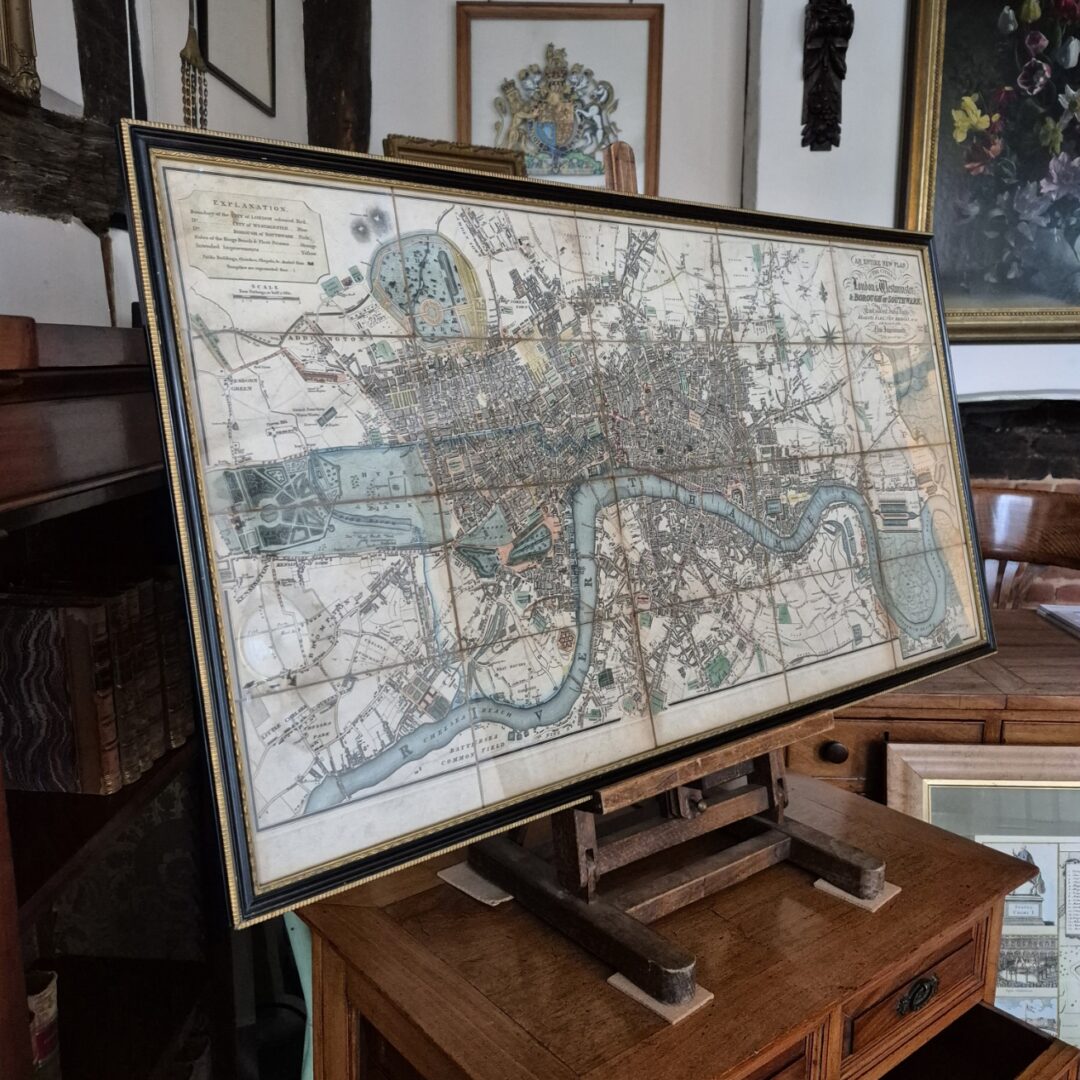
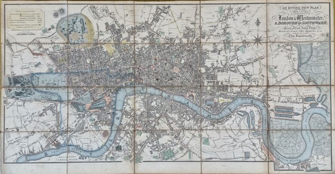
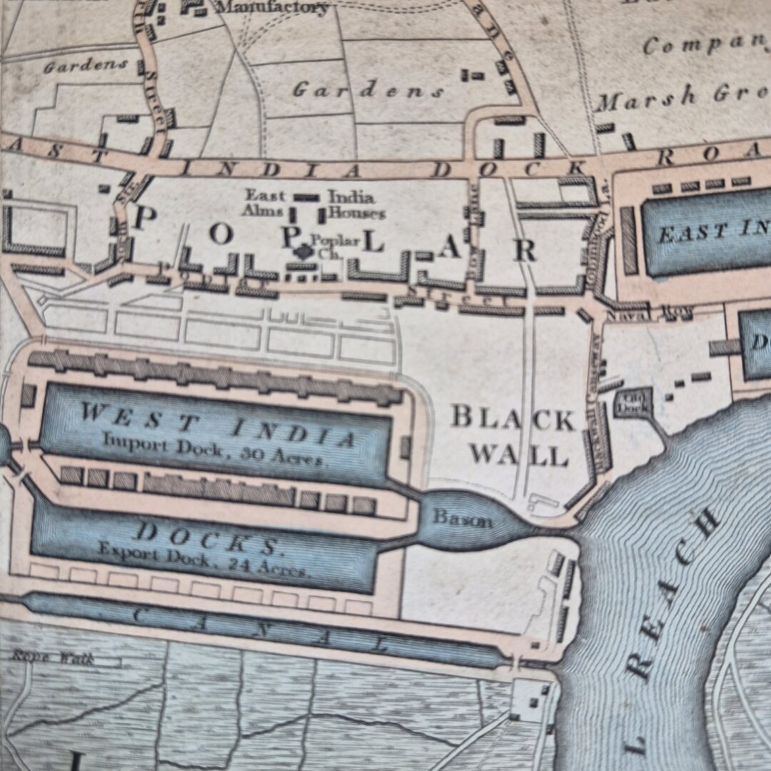
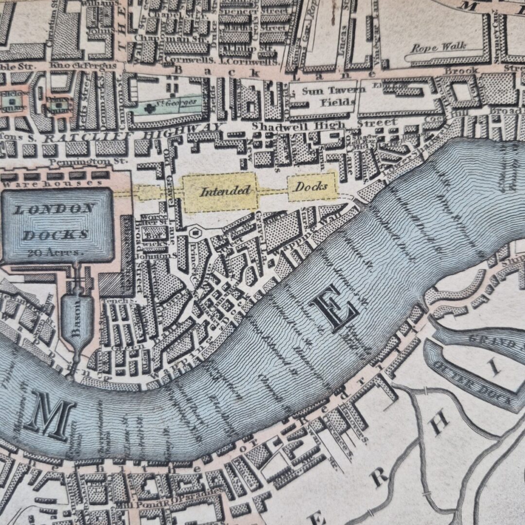
Description: This original William Darton's map of London, published in 1817, offers a comprehensive depiction of the city as it expanded eastward from Stepney to Greenwich Marsh. As a fold-out map, it is informative and visually very appealing in its own right, but when displayed in its entirety within a Hogarth style frame, as it is now, it rarely fails to attract ones attention. This map offers a vivid snapshot of London's transformation during the early nineteenth century. It captures the city's expanding boundaries and highlights both new urban developments, such as Regent Street and the East and West India Docks. The map serves as a testament to the dynamic interplay between innovation and heritage in London at that time. This map is notable for illustrating the location of Regent Street, which was soon to be constructed, connecting Oxford Street to Piccadilly. Alongside Regent Street, Darton highlights numerous other proposed improvements, reflecting the dynamic changes taking place in the metropolis at the time. The map, titled "An entire new plan of the cities of London & Westminster & borough of Southwark; The East & West India Docks, Regents Park, New Bridges etc. with the whole of the New Improvements of the present time, July 1st. 1817," encompasses a wide area of London. It stretches from Kensington Palace and World's End in the west, to Islington in the north, West Ham, the East and West India Docks, and Greenwich in the east, and finally to the Oval and Battersea Bridge in the south. Darton distinguishes the planned improvements by marking them in yellow. These enhancements include the areas surrounding Tavistock Square and Bryanston Square, as well as the docks at Shadwell. This early edition of the map features Nash's design for Regent Street and Piccadilly Circus, which are superimposed over Swallow Street's original layout, demonstrating the evolving urban landscape. Despite London's rapid development, Darton's map reveals that certain traditional features persisted. For example, 'Osier Beds'—areas dedicated to cultivating willow for basket making—could still be found behind Chelsea Hospital. This detail underscores the coexistence of new improvements with longstanding local practices during this transformative period. A very decorative and desirable map of Regency London. The measurements of the frame are 94 cm wide x 50.5 cm high.
Contact us on 01306 770212 about this item
Enquire About This Item